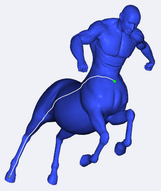
I'm trying to evaluate a geodesic distance matrix on the TOSCA dataset.
e.g. the following 3d mesh-

I've tried using two python implementations.
- The first one is the scikit-fmm, which does not seems to work on 3d structures at all (am I right?) hence not suitable to the task.
The other one is the gdist package, which Unfortunatlly works on the toy example they provide, but does not work on my mesh, which is only 10,000 faces and 5000 vertices.
When using the gdist library I have the following error:Process finished with exit code 139 (interrupted by signal 11: SIGSEGV) --------CODE SNIPPET---------- c = sio.loadmat('raw_data/TOSCA/cat0.mat') c = c['surface'][0][0] X = c[0] Y = c[1] Z = c[2] TRIV = c[3].astype(np.int32) vertices = np.array(zip(X, Y, Z)).astype(np.float64) vertices = np.reshape(vertices, (vertices.shape[0], 3)) src = np.array([1], dtype=np.int32) trg = np.array([2], dtype=np.int32) np.random.shuffle(TRIV) a = gdist.compute_gdist(vertices,TRIV[:5000], source_indices = src, target_indices = trg)
Is there another solution? Am I using gdist or scikit-fmm the wrong way?


