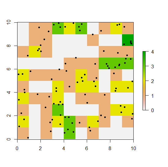
I have made a reference grid, cells 50x50m, based on GPS locations of a collared animal. I want to do the equivalent to a spatial join in ArcGIS, and count the number of points in each cell.
I have made a reference grid, using a SpatialPointsDataFrame object (the data frame is already projected, using UTM coordinate system)
RESO <- 50 # grid resolution (m)
BUFF <- 500 # grid extent (m) (buffer around location extremes)
XMIN <- RESO*(round(((min(dat.spdf$Longitude)-BUFF)/RESO),0))
YMIN <- RESO*(round(((min(dat.spdf$Latitude)-BUFF)/RESO),0))
XMAX <- XMIN+RESO*(round(((max(dat.spdf$Longitude)+BUFF-XMIN)/RESO),0))
YMAX <- YMIN+RESO*(round(((max(dat.spdf$Latitude)+BUFF-YMIN)/RESO),0))
NRW <- ((YMAX-YMIN)/RESO)
NCL <- ((XMAX-XMIN)/RESO)
refgrid<-raster(nrows=NRW, ncols=NCL, xmn=XMIN, xmx=XMAX, ymn=YMIN, ymx=YMAX)
refgrid<-as(refgrid,"SpatialPixels")
To make sure my grid was in the same projection as the SpatialPoints:
proj4string(refgrid)=proj4string(dat.sp.utm) #makes the grid the same CRS as point
count.point function in adehabitatMA seems like the function that will do the trick
cp<- count.points(dat.spdf, refgrid)
But I get this error:
Error in w[[1]] : no [[ method for object without attributes
Is this not the right route to take to achieve my goal? Or how can I resolve this error? Or would the over function (sp package) be more suitable?
output from SpatialPointsDataFrame (dat.spdf)
dput(head(dat.spdf, 20))
structure(list(Latitude = c(5.4118432, 5.4118815, 5.4115713,
5.4111541, 5.4087853, 5.4083702, 5.4082527, 5.4078161, 5.4075528,
5.407321, 5.4070598, 5.4064237, 5.4070621, 5.4070555, 5.4065127,
5.4065134, 5.4064872, 5.4056724, 5.4038751, 5.4024223), Longitude = c(118.0225467,
118.0222841, 118.0211875, 118.0208637, 118.0205413, 118.0206064,
118.0204101, 118.0209272, 118.0213827, 118.0214189, 118.0217748,
118.0223343, 118.0227079, 118.0226916, 118.0220733, 118.02218,
118.0221843, 118.0223316, 118.0198153, 118.0196021), DayNo = c(1L,
1L, 1L, 1L, 1L, 1L, 1L, 1L, 1L, 1L, 1L, 1L, 1L, 2L, 2L, 2L, 2L,
2L, 2L, 2L)), .Names = c("Latitude", "Longitude", "DayNo"), row.names = c(1L,
2L, 3L, 4L, 5L, 6L, 7L, 8L, 9L, 10L, 11L, 12L, 13L, 15L, 16L,
17L, 18L, 19L, 20L, 21L), class = "data.frame")
And summary:
summary(dat.spdf)
Object of class SpatialPointsDataFrame
Coordinates:
           min      max
Longitude 610361.0 613575.5
Latitude  596583.5 599385.2
Is projected: TRUE
proj4string : [+proj=utm +zone=50 +ellps=WGS84]
Number of points: 5078
Data attributes:
Latitude       Longitude       DayNo
Min.   :5.396   Min.   :118   Min.   :  1.0
1st Qu.:5.404   1st Qu.:118   1st Qu.: 92.0
Median :5.406   Median :118   Median :183.0
Mean   :5.407   Mean   :118   Mean   :182.6
3rd Qu.:5.408   3rd Qu.:118   3rd Qu.:273.0
Max.   :5.422   Max.   :118   Max.   :364.0


refgridis of class (or inherited class)SpatialPixels? – Mariandisummary(refgrid) Object of class SpatialPixels Coordinates: min max x 609850 614100 y 596100 599900 Is projected: TRUE proj4string : [+proj=utm +zone=50 +ellps=WGS84] Number of points: 6460 Grid attributes: cellcentre.offset cellsize cells.dim s1 609875 50 85 s2 596125 50 76– Stridulousrefgridas a raster, you can build ontable(cellFromXY(refgrid, dat.spdf)). – Escentr <- raster(refgrid); r[] <- 0; tab <- table(cellFromXY(refgrid, dat.spdf)); r[as.numeric(names(tab))] <- tab– Escent