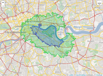
My question is very simple and can be understood in one line:
Is there a way, tool, etc. using Google Maps to get an overlay of all surface which is below a certain time of travel?
I hope the question is clear, but I coulnd't find anything related on the web.
If you have any information, I'll take it!
Here is what I mean illustrated by an example:
I search for a new place to live. I know the precise address of my office. I would in this case be able to overlay on Google Maps the surface which is under a certain time of travel (let's say 30 minuts by car). We would have a long surface colored around motorways (because you get faster), and colors around roads.


