This is pretty weird. I have a Geochart that is pulling data from a Google Sheet. I am using Latitude and Longitude to identify the location of the markers as it is way faster and precise that using ISO 3166-1 or country names.
Now, this is my script: JSFIDDLE
As you can see, it works. BUT since the content of the Google Sheet I am pulling the data from is supposed to be dynamic, meaning that the list of countries could change in the future (the order or the number of countries listed), I'd like to output the Latitude and Longitude values with a formula (instead of having fixed values):
IF($H$2:$H = "AD";"42.546245";
IF($H$2:$H = "AE";"23.424076";
IF($H$2:$H = "AF";"33.93911";
IF($H$2:$H = "AG";"17.060816";
etc
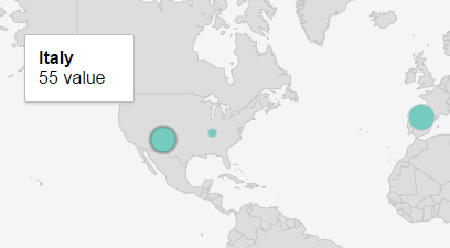
The result is the same but for some weird reason (I guess related to the locale of the document), if I point my Geochart to this second Google Sheet with the same exact content of the first one but with the only change being the way in which the Latitude and Longitude values are pulled (with the formula above instead of manually typed), the script wouldn't like that and the map would show Italy in the US (for example!):
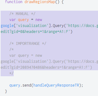
You can try by yourselves, changing the commented out query to the second Google Sheet (and commenting back the first one).
You'll see that the map loaded is way slower and the markers are all in wrong positions (and only 3 get loaded instead of >30). You can also take a look at the spreadsheets directly, the links are in the fiddle.


IF($H$2:$H = "AD";42.546245;– Debtformula parse errorwas because he didn't like dots but was okay with commas. So I changed the formula for both Latitude and Longitude toIF($H$2:$H = "AD";1,601554; IF($H$2:$H = "AE";53,847818; IF($H$2:$H = "AF";67,709953; ...but the result was the same.. markers in wrong positions , really slow and only 3 displayed on the map. – Steffie